Python Script 1:
 |
| Figure 1: python script used to project rasters |
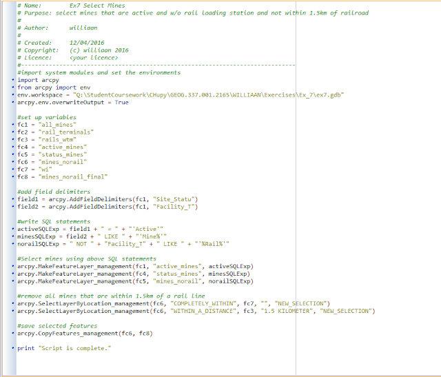
Python Script 2:
In Exercise #7, we wrote a Python script to select the frac sand mines that were:- active
- not within 1.5 kilometers of a railroad
- without a rail loading station
 |
| Figure 2: python script used to select mines |
Python Script 3:
In Exercise #8, we wrote a Python script to create a weighted index risk model for mining locations:
 |
| Figure 3: python script used to create risk model |
No comments:
Post a Comment